Slept even later than usual, didn’t get out of bed till past 8:30, having heard the sound of a vehicle pass us, evidently the park workers came in to clean. I went out to feed the horses and discovered it was wet outside. Not exactly a rain as much as a collection of humidity dropping from the trees, and it was quite cool, in the low fifties. I covered up the hay with a tarp to protect it. After breakfast, Hubby finished re-working the drill pump setup, even adding a makeshift filter to keep the hose from clogging up, then we finished filling up the horses’ tubs plus a spare. It being so cool, they aren’t drinking much anyway. Though we had planned to ride today, with the weather being so damp and chilly, we thought the better of it and stayed in for the day, mostly reading and watching movies. Good idea, actually, helped us recover from last weekend’s long rides!
Archives for August 2010
Monday, August 9, 2010 – Travel Day to Stagecoach Horse Camp, Tillamook State Forest
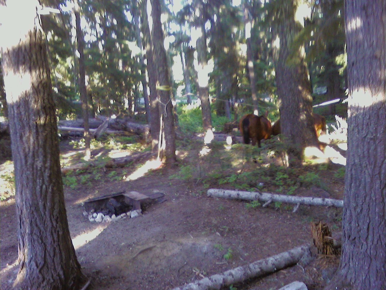
Didn’t get up too early, as the trip today is only about 2 ½ hours long, though we did need to stop and shop for groceries and to buy some green coffee beans (Hubby roasts his own) in Portland. Found a Safeway store before we got on the highway with relatively inexpensive gas, did our food shopping and jumped onto I-5. Stopped at the rest area to dump, then went into downtown Portland to get out beans a the Portland Roasting Company. They didn’t ordinarily sell green beans, but did make the occasional exception for folks like us who roast there own. It turned out to be a rather circuitous route, but we did get a good look at Portland, trolley cars, storefronts and derelicts and all. Finally got back on the highway, and after a bit of climbing (we’re only at about 2000 feet, so it’s not at all like really climbing), we turned onto the gravel road that would lead us to the Horse Camp in about 5 miles. We arrived to a narrow camp road, with only 11 sites, most of which were only suited for small rigs. There were a couple of larger sites, but they were a long way from the water source, which is a makeshift trough with a hose that gravity feeds off a small creek. I had forgotten about filling up our RV tanks until we were halfway up the gravel road, so we figured we would have to conserve, and maybe use the stock water for washing dishes, and skip our bi-weekly shower until we got to our next location, thinking at the time the stock water would be from a spigot like the last camp. No such luck. The best site for us would have been perfect, right next to the creek, except it had a huge set-in fire grate right in the middle of the area we would like to park. Not to be deterred, we backed in over the top of it as far as we could, and just managed to barely be back far enough to be off the road. Had the silly fire grate not been there, we could have gotten another 6-8 feet back, not blocked the corrals at all, and had plenty of room for the pickup as well. I really wish the Forest Service would have an expert come in and look at their campsites, it would be so easy to improve them in a way that would make them much more attractive, and bring in more user fees. Of course, I should mention this is a state forest, but nevertheless, why build a horse camp without understanding what horse campers need? I will give them credit, though, about one innovation we hadn’t seen before. The corrals had high crossbars on them, and at first I couldn’t understand why, but then I realized that the middle one was higher, and that if you put a tarp across it, you would create a temporary roof for when it rains. A good idea for an area like this, where it apparently rains a lot. Anyway, we had to spend another hour rigging up the generator, the drill pump and a hose system so that we could pump water from the creek to the horses. It was too steep to carry up tubs, so in the end, we felt this was the best solution. The only other one would be to walk the horses to the trough, which isn’t far, but we like it better when the horses can drink for themselves. We weren’t sure our little drill pump would have the power to push water that far and at that much of an incline, but it managed quite well. As it was getting late, we only filled the tubs about half full, with plans to finish it off tomorrow. Had a bite of dinner, watched a movie, off to bed, still tired from our two long rides over the weekend.
Sunday, August 8, 2010 – Another Ride Day
The day started out a bit misty again, but cleared up nicely throughout the morning. We had decided to take another, shorter ride today, and on the suggestion from one of the folks from last night, we decided to head to the Kalama Falls, which were supposed to be lovely. When I asked this morning how long a ride it was, one of the ladies said two miles, but was contradicted by one of the men who said five miles. Not wanting to take a long ride today, I hoped that five was the outside, as that would still make it almost 3 ½ hours, the max we wanted to be out. We got out about 11:45, heading out the same trail as yesterday, but with a quick turn to the right that headed us out toward the Falls. Again, we were thankful for the extra signs and ribbons left behind by the Fun Ride group, as the regular trail markers were sorely inadequate. Part of the problem was that Kalama Falls wasn’t actually part of the National Forest, so it wasn’t on any of the maps we had, so it was guesswork the whole way. It started out nice, but again turned rocky before long. We eventually came to a dispersed camping area with some young men misbehaving in the woods, and almost lost the trail but for the ribbons. We crossed Forest Road 81, and continued on through more rocky trails until we came to a gravel road that had no signs and no ribbons. We noted hoof prints scattered around, but most of them seemed to go kitty corner across to a berm of gravel, then on to a grassy road behind it. We made the same choice, and were rewarded about 100 yards up with another ribbon. That was the nicest part of the trail, mostly grass and a good place to get some trotting in, though it began to climb again. That eventually rolled into another gravel logging road, and we had now been out for more than two hours, already past our point of no return if we wanted a three hour ride. We made the decision that if we didn’t hear the falls soon, we’d head back. Well, shortly thereafter we heard the falls, and the ribbons indicated a right turn. We could heard the falls off to our left, but then the ribbons indicated a right turn onto a lava field. We followed the ribbons, but they petered out, as did the trail, and the sound of the falls diminishing. We stopped at a campsite and had lunch, planning to head back immediately. As we came out of the lava field on to the road, however, I noticed a trail across the road. I suddenly remembered something one of the folks from last night had said, “Leave your horses in the lava field and walk down to the falls.” So I persuaded Hubby to let me hike down the trail to see if, in fact, we were in the right place. Indeed we were! I came back and we led the horses to a little grassy area along the trail, then hiked down a very short ways to the river. Going left to the end of the trail, I found a beautiful view of the falls and the two streams that came together at that point. There was a huge tree that had fallen (or been put, though I don’t know how!) that had obviously become a much used footbridge across the lower stream, so we crossed it and followed the trail to near the base of the waterfall. Had we wanted to climb across rocks, we could have stood under it, but we were already taxed from the long ride, and knowing we had a long ride back simply took a few pix and headed back. It was a beautiful spot, it was just that it was more live 6 ½ to 7 miles each way, something we really hadn’t wanted to do, but hey, we were there, we made it, we made the best of it! The trip back ended up being shorter, partly because we did a bit more trotting and even cantering along the grassy road (as we were descending now, it wasn’t as hard on the horses), and followed the road for the last bit, avoiding the rockiest part of the trail. We did eventually turn back onto a trail that seemed to head in the right direction, and sure enough, it brought us right to the campground trail. My gelding immediately turned left, knowing he was almost home, though I couldn’t have said for sure which way to go. Minutes later we arrived at our campsite, exhausted after another long ride. We didn’t go socializing tonight, we were just too tired and a bit sore. Looking forward to a good night’s sleep in preparation for our travel day tomorrow!
Saturday, August 7, 2010 – Ride Day at Kalama (Mt. St. Helens)

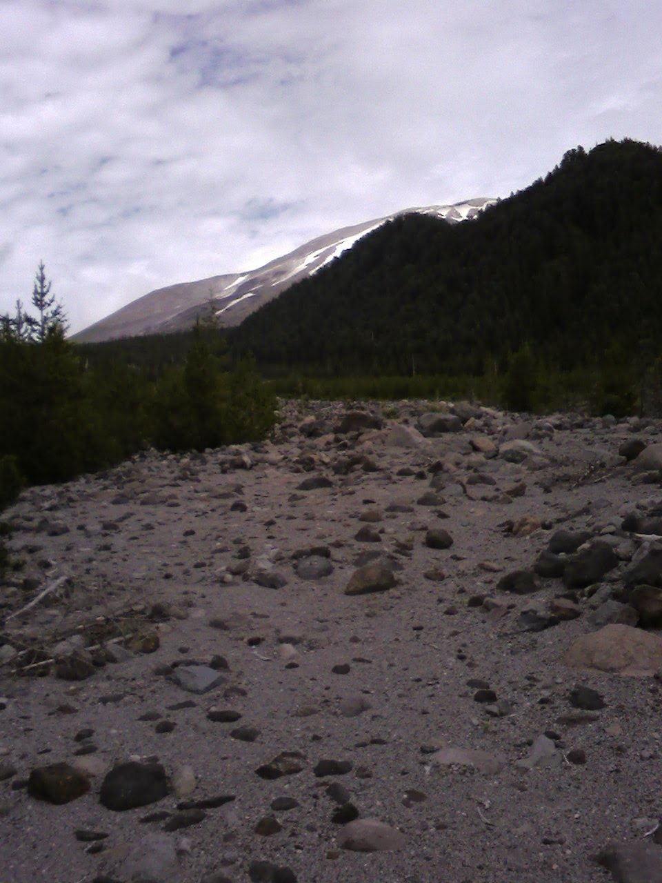
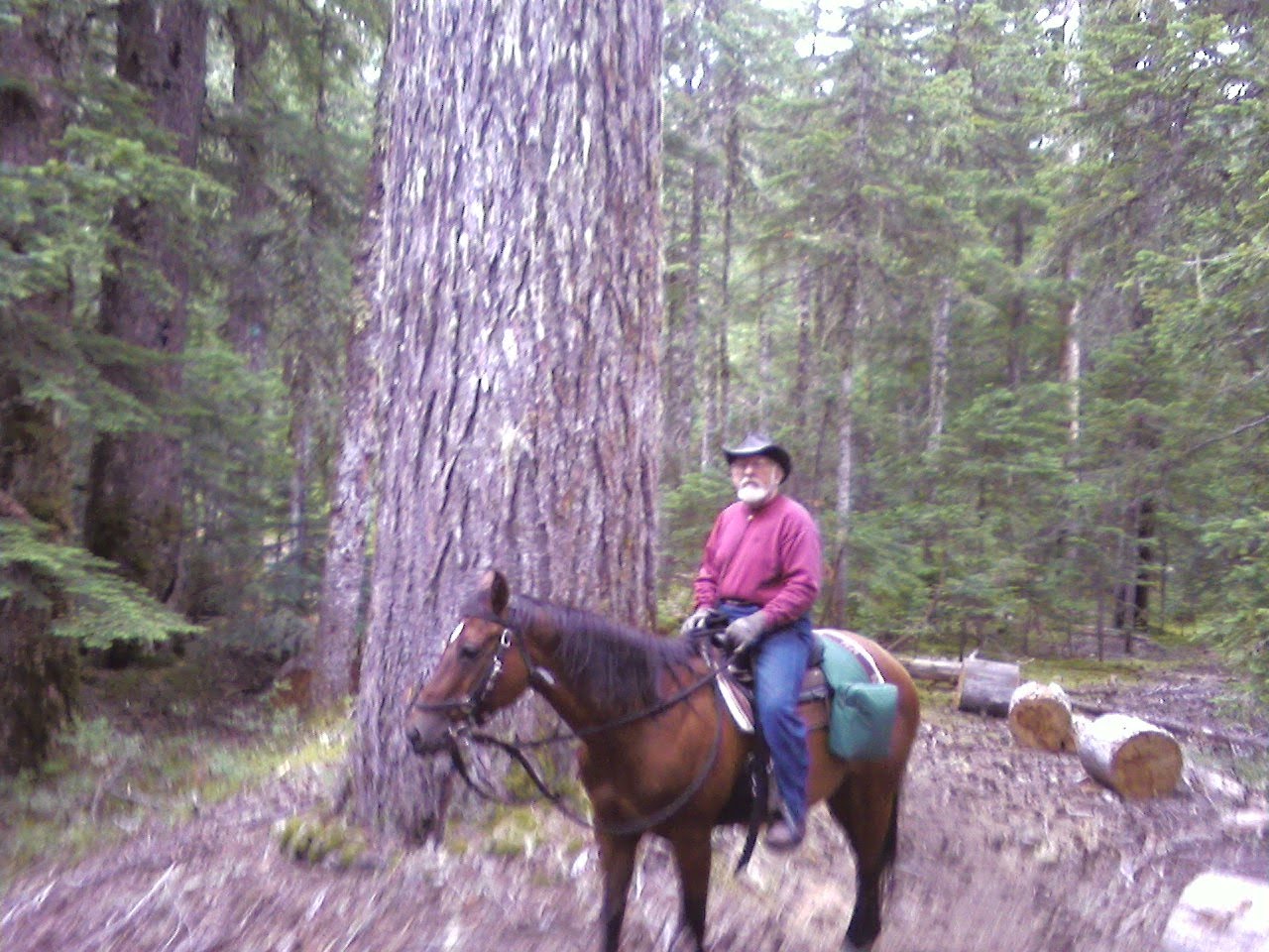
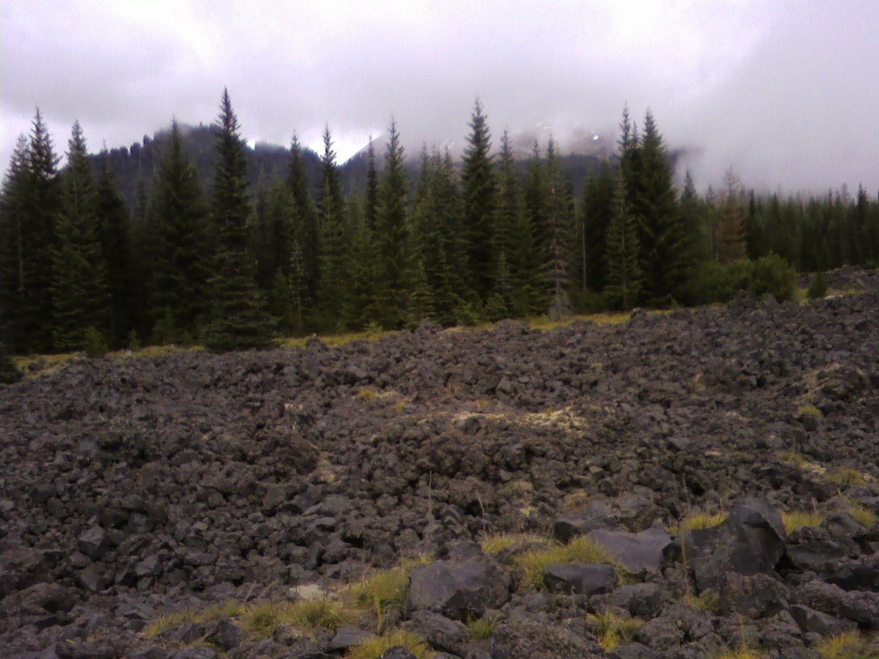
Slept rather late, nothing like a patch of peace and quiet to get a good night’s sleep! We headed out on the trail about 11:00. The trailhead has two separate trails leading out, one is Fossil Trail on the left, the other is Toutle Trail, which forks out later into Cinnamon Trail as well. We took Toutle Trail (328) toward Red Rocky Pass, which was a lava field with a great view of the mountain. We had heard Cinnamon Trail was very difficult, so we took a pass on that one. Toutle Trail took us past some huge pine trees, even larger than the ones we saw at White Pass. I guess the further west we go, the bigger the trees will get! The day was a bit misty, with a forecast calling for afternoon rain, but that is obviously quite typical here, as these massive trees also had moss hanging from their limbs, something we haven’t see since Louisiana. It was quite a nice ride to Red Rocky pass, albeit a constant climb, though the trail was a bit more rocky in places than we would have liked. The first part of the trail was covered with a fine gray ash, obviously a remnant of the volcano exploding some years back. We passed McBride Lake, circling on a rather narrow trail with steep drop that I wouldn’t recommend for an unseasoned horse. The climb ended at the trailhead near the lava field, which was a bit harrowing. Though some effort had been made to create a path on top of it by filling in the gaps with gravel, there were a few spots that were straight sharp-edged black rock. Thank goodness for Easy Boots! The unfortunate thing was that it was still so misty, we couldn’t see anything but the base of the mountain, and a quick glimpse of a bit of snow during one brief moment when the clouds moved a bit. We stopped for lunch shortly after at the junction of 238 and 231, where Hubby inadvertently left behind his gloves on a stump, then headed back toward the camp on 231, a decision we somewhat regretted, because there were long section of very rocky trail, including two lava flows we had to cross, that were nothing but big boulders and sharp rocks, and almost no trail to speak of. In fact, we never would have found our way across if it hadn’t been for ribbons someone had put up for a “Fun Ride” a few weeks earlier. I’m not sure I would consider taking my horse across a quarter mile of rocks “fun”, but trooper that he is, we made it with minimal discomfort. The trail was very rocky most of the next few miles, with signs that the last explosion of Mt. St. Helens everywhere, dead trees and large black rocks that had obviously just landed hither and yon. Eventually the rocks diminished a bit as we slowly descended. We reached a steep section, and part way down we started hearing firearms, as though someone were target shooting at the bottom of the hill. As we got closer, I yelled to hold your fire, horses coming, but the firing continued. Between earplugs and a radio blasting rock and roll, there was no chance of them hearing me until we were practically on top of them. I finally did manage to get their attention (there were three of them, two men and a woman), and they were kind enough to stop while we passed, though they started up again before we even left the parking area where they were set up. Fortunately, the horses were only mildly concerned, they’ve heard guns before, just not that close up. We crossed the road where the trail go a little less rocky, and were back in the camp in no time. In all, the ride was about 4 ½ hours long, a good length, though everyone was tired. Gave the horses an extra ration of oats, then made a quick dinner for Hubby (I’m dieting 🙂 before we went down to visit with the folks down the road. We spent a pleasant evening chatting, with a bit of theatrical entertainment provided by Hubby, which met with warm enthusiasm from the group. Having not made a habit of socializing, it was a nice change. Came back around ten, to bed soon after.
Friday, August 6, 2010 – Runaround and Repair Day
Hubby left in the van to go hunt down the parts he needed to repair the hitch among other things, while I remained behind to clean house and so some little repairs. Our gas water heater had stopped working last night, so I cleaned that out good with a wire brush and that eventually did the trick. Did a whole bunch of stuff, kept busy until just before Hubby got back, then helped him with the hitch repair. Later in the evening, I took a walk around the campground in search of information about the trails here, eventually finding a group of three couples who are local, but hadn’t been here in years, but they did their best to answer my questions. I had a good trail map, it was just a matter of which one would afford us a good view of Mt. St. Helens, which is the centerpiece for this area. Relaxed the rest of the evening, looking forward to our ride tomorrow.
Thursday, August 5, 2010 – Drive Day to Kalama Horse Camp, WA
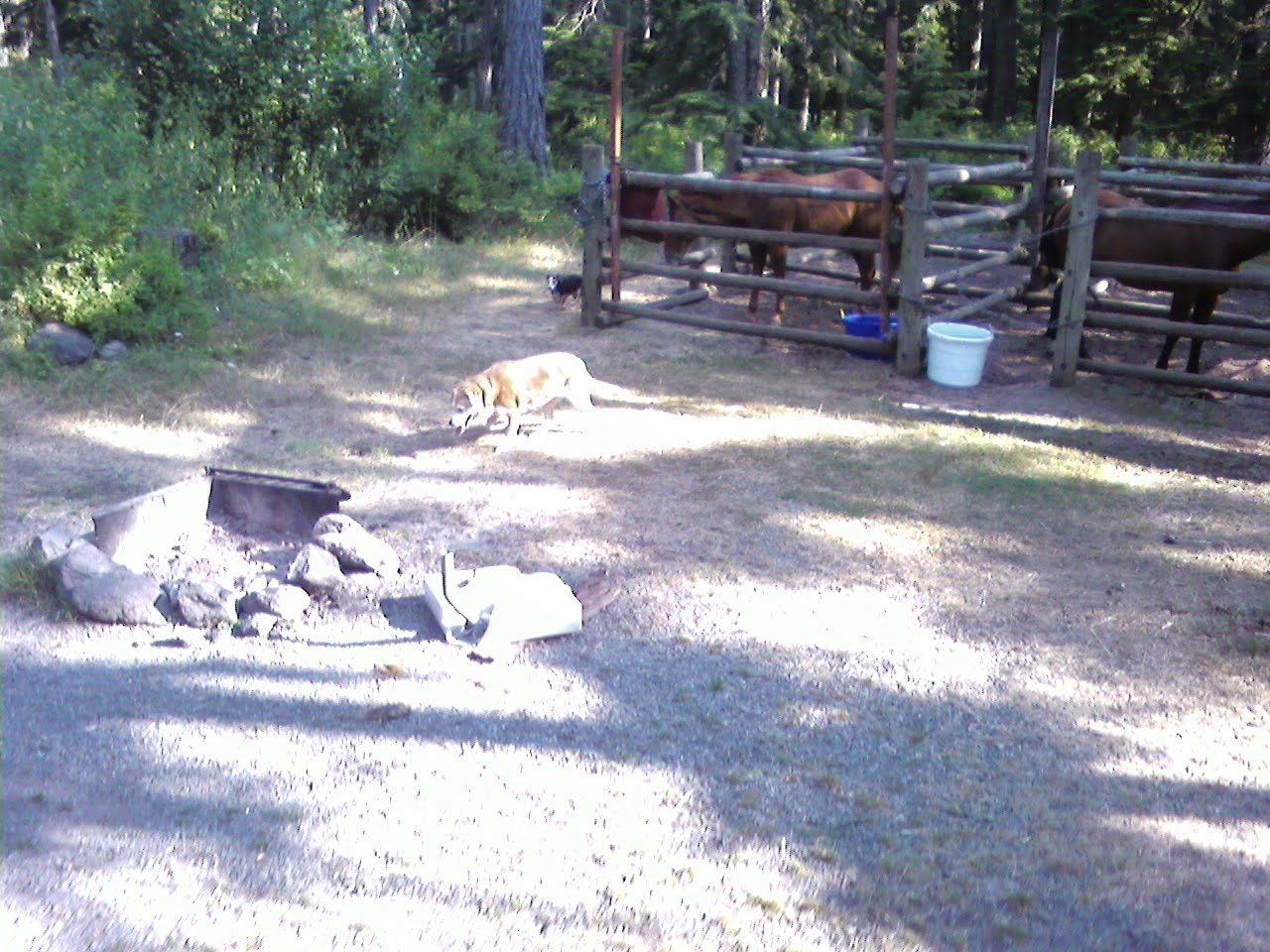
Decided to take the long way around, via I-5, because we were concerned about the Forest Road being gravel, and didn’t want to travel 70 miles on gravel, and also because we had some shopping to do. Stopped in the city of Longwood to do that, then traveled (with some construction delays) to the little speck on the map called Cougar. Fortunately, the gas station there had a water spigot outside, so we were able to fill up before backtracking to the horse camp (just a mile out of the way). We were pleasantly surprised to find that the road to Kalama Horse Camp was completely paved the entire 8 miles, making it a very easy journey. After touring the camp, we decided on site 24, as it was large enough and right next to one of only two water supplies (non-potable, for the horses only). Every site had corrals and was nicely wooded, though ours had enough clearance for Hubby to get a satellite signal. It wasn’t exactly level though, so after some discussion, Hubby decided to unhook the RV from the van to make it more level. In doing so, he discovered that one of the two huge bolts that attached the trailer hitch to the van had sheared off completely. It was a wonder on the windy twisty road up here, we didn’t lose the trailer entirely! Thank goodness we noticed it before reaching US 101 (the Pacific Coast Highway), one of the twistiest roads with the sheerest drops around! That meant our schedule for tomorrow wouldn’t include a ride, unfortunately, but maintenance is a must to keep things safe.
Wednesday, August 4, 2010 – Ride Day
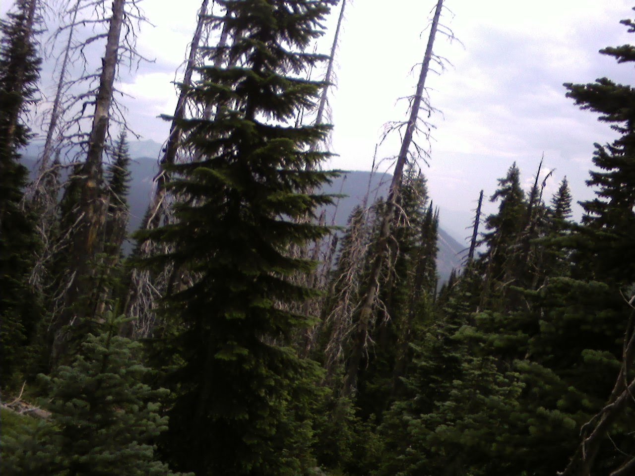
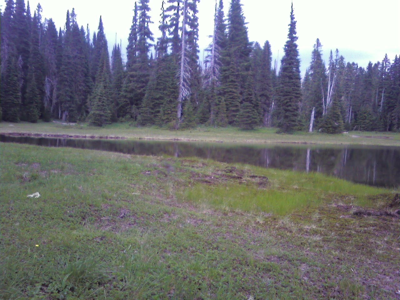

Slept late, still feel like we’re catching up on zzzz’s, I guess we need a day that we REALLY take off, completely! Nevertheless, we were out of the campground, with boots, by 11:45. The only maps I could find on the internet in this area were cross-country skiing maps (there’s a ski lodge just across the street), which also happened to be good for horses, too, and the Pacific Crest Trail which apparently runs the entire length of the North American continent. We took a few of the short loops, then finally found the intersection for the Pacific Crest Trail (though it was only marked no bicycles at that point), where a pair of hikers assured us it was the right on, and they were kind enough to let us go first so we wouldn’t have to pass where it was more narrow. We climbed and climbed (again) in search of views of Mt. Ranier, which we never quite found, before heading back down to a lovely area full of lakes and grass for lunch, then back by 4:15. The trails were fine, mostly dirt with some areas of rocks, and the trees were magnificent tall firs, many of them hundreds of years old. The trail was well maintained, with quite a few foot bridges over muddy spots and no trees across, all had been cut up. Really pretty, and the weather was perfect, partly cloudy in the seventies. We even passed a surviving patch of snow, would you believe! The first week of August and it was still holding out! Settled down for the evening, catching up on the blog while I have a good signal Not so sure I’ll have one tomorrow!
Sunday, August 1, 2010 – Travel Day to Ellensburg, WA
Uneventful travel day, found a dump at a rest area, then traveled to our overnight stay at a wilderness area called Robinson Canyon. Conveniently close to the freeway, but the last half mile was on EXTREMELY rough roads. Discovered the creek that ran through it was dry, so we had to use every spare gallon of bottle water we had, plus some out of our diminishing RV tank to satisfy the horses. Too tired to do much of anything but crash. A well-used spot, though, lots of signs of equine activity.
Tuesday, August 3, 2010 – Work Day
Though I hadn’t intended to work all day, that’s what I ended up doing. Hubby decided he had had enough of mountains, so I started revamping the tour, which originally had us in mountains for the next few weeks before hitting the coast. After an afternoon of effort, I managed to rearrange everything so that we would have just one more stop in the mountains before heading west. Hubby did a few little chores, then spent the rest of the day reading a new book he just can’t seem to put down. Looking forward to having the time to do that myself…. Can’t get a satellite signal here, but the cell phone has 3-4 bars, so getting broadband was easy enough. Still time consuming though. Anyway, to bed, for tomorrow we ride!
Monday, August 2, 2010 – Breakfast with a Friend and Travel Day to White Pass
 Had arranged to meet an old friend for breakfast at the Perkins at about 10:00, enjoyed catching up with him for the next 3 hours, a bit longer than intended, but then again, that always happens when we get together :-). The headed out towards Yakima, stopped there for gas, groceries, water and Home Depot before heading up to White Pass Campground, which has a loop for horses, conveniently located right off state highway 12. Stopped at the Ranger Station looking for maps (which they were quite happy to sell me, but didn’t have any freebies, so I declined.) We arrived later than we had hoped, but in plenty of time to get everyone settled quickly enough. Had to take a run down to the lake for water for the horses (none on site), then we crashed quickly, still feeling exhausted from our busy week.