Spent the day getting ready for our the workshop we came here to facilitate.
Archives for September 2010
Thursday, September 16, 2010 – Drive Day to Cherry Valley
September 17, 2010 By Leave a Comment

Got up early and headed out. The trip was actually easier than we expected, mostly freeway driving, and the stable that we had booked (the JayGee) was only a few miles from I-10, so we actually arrived fairly early, by about 2:30. We got the horses settled in to two nice big corrals with a small cover in each corner for shade, then got the RV parked and opened up. There’s a nice breeze here that Judy, the owner, says is perpetual, which will be a relief on hot days. Settled down for the rest of the (thankfully) uneventful day.
Wednesday, September 15, 2010 – Relaxation Day
September 15, 2010 By Leave a Comment
We decided we had seen enough of the trails here, and that our fabulous horses deserved a much needed day off after a tough week and in anticipation of a long day of driving tomorrow. I need the day to get caught up on work, so we spent the day at the ranch.
Tuesday, September 14, 2010 – Ride Day at Sequoia National Forest
September 15, 2010 By Leave a Comment
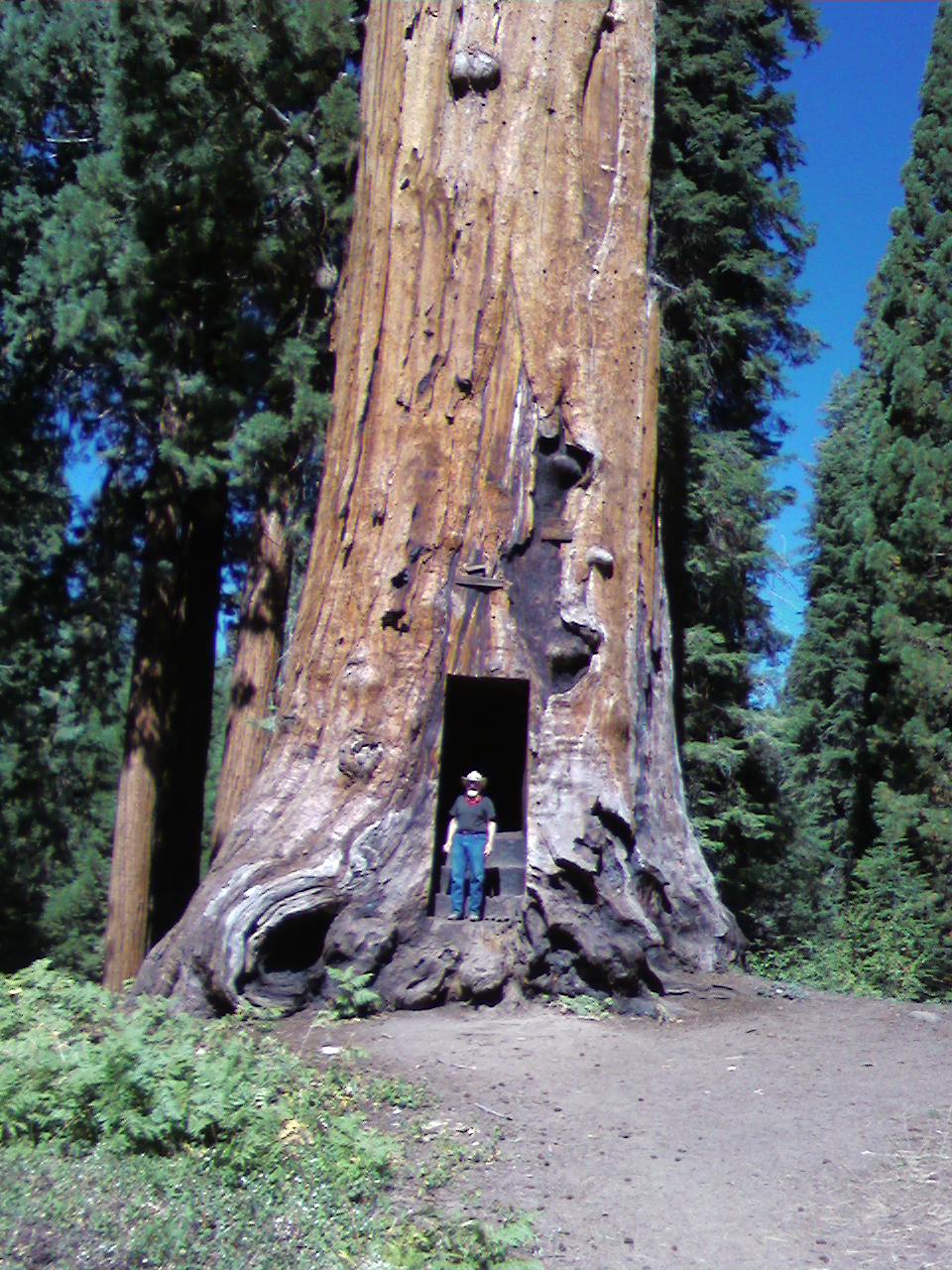
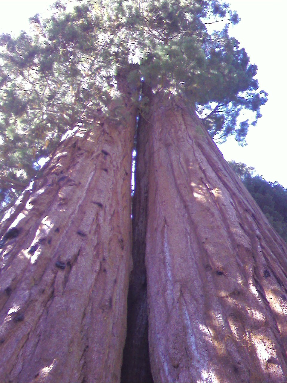
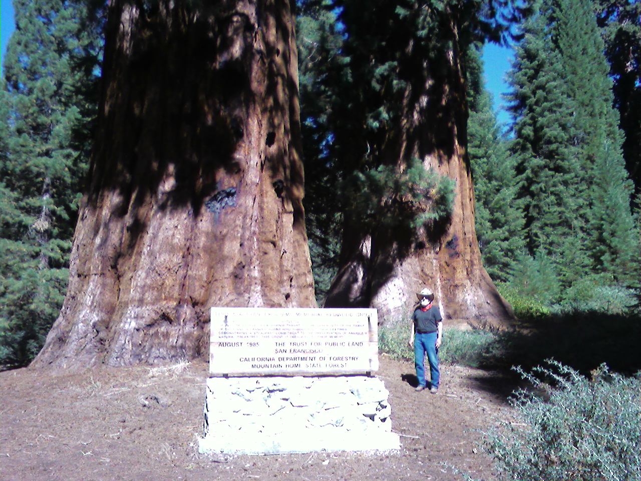
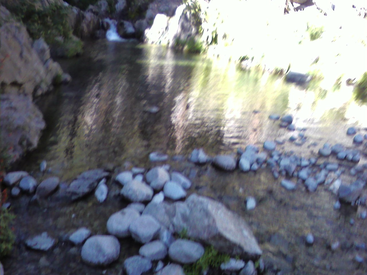
Up early, packed the horses into the trailer and headed out by 9:30. We headed up to Shake Camp, where there are public corrals and a trailhead just past the concessionaire pack station. We first stopped at the entrance to the grove, where there were several huge trees, including one that had been carved out by a man as a hunting cabin back in the 1800’s. Took a few pix then headed on to the pack station and spoke to Tim (from Johnson City, TN, but who moved out here 31 years ago), getting some direction about the trails, which turned out not to be too terribly helpful. Trail maps were almost non-existent, despite a stop at the Ranger Station yesterday. The only thing we could get our hands was an old Mountain Home State Park map, which turned out to be extremely inaccurate. To make matters worse, the trails signs were few and far between, the trailheads weren’t very well marked, there were many trails with no signs whatsoever. In the end, we spent the day almost entirely lost. We wanted to take the 2-mile loop to the Adam tree, which is the 17th largest living tree in the world, but we headed out the wrong trail and ended up going miles out of our way on some very tough trails, looping all the way around to Hidden Falls. We followed the road for a bit, then found a trail (unmarked) that looked like it headed back to Shake Camp, and fortunately it did. We had planned on taking a short ride at this spot, then perhaps loading up the horses to go to other hot spots, but by the time we got back to Shake Camp it had been over four hours of rough riding, and we were tired. I was still determined, though, to find this Adam tree, so we headed up to the pack station and happen to run into Tim again because there were several trailheads from that area, and asked again about the trail to the Adam tree. He gave us some general directions, up the trail, stay right, then up the hill. Well, we followed those instructions as best we could, and ended up nearly back to the trailer, so we turned again and climbed up a steep hill, and somehow missed it again. Ended up on a road that led us back to another road the led to the pack station. By this time we were so frustrated we were beside ourselves, and gave up. We packed up the horses and headed out, missed the road we came in on (no sign) and ended up on a long tedious windy narrow route in the wrong direction, that eventually worked it’s way around back to the road we wanted, adding another 5-6 miles to an already long trip. The road down seemed to go on forever (about 22 miles of 15 mph windy roads), and arrived back at the ranch at just after sunset. A tough day, the trails not worth the effort to get there, unfortunately. A big disappointment that, if the forest service wanted, could be a gem of a recreational area with just a little effort.


Monday, September 13, 2010 – Drive Day to Springville, CA
September 14, 2010 By Leave a Comment
The goal is the Sequoia National Forest, or the Mountain Home State Forest, but I’ve had so much conflicting information about the facilities, we made the decision to find a stable in the town of Springville at the base of the forest area (elevation 1000′) and trailer in for day rides. While there are apparently a couple of campgrounds in the forest, the reports on the roads in seemed to indicate they are all very twisty, hard on a trailer, and the camps are at over 6000′ and most don’t have facilities for a rig as big as ours. We made arrangements with a very nice woman (horse people all seem to be pretty nice, fortunately) named Judy Brey, proprietor of Shady Oaks Ranch right in Springville, to corral our horses and park our RV while we’re here. After stops at a rest area to dump and a Walmart, we arrived at the ranch just after 3:00. We found a great shady spot for the RV, and put the horses away in the corrals nearby. Got the satellite up and running, and got settled in. The only problem is, despite the fact we’re actually in a town, there is no Verizon signal here (can you hear me now?), so I had to run back about 10 miles to get a signal and make a few calls and check my email. On the way back, I drove slowly through town looking for a wifi signal, and found one near a place called Wild Places, so now I know where to go to check email a very short distance away. It doesn’t solve the problem of a cell phone signal, but that will have to wait. Meanwhile, we noticed a curl of smoke coming out of the mountains, and we were worried that the park might be closed due to wildfires, but we learned that fire was started by lightning back in July, and had been smoldering in the wilderness since then. Apparently the conditions were just right for a flare up, nothing to worry about. We could see it glowing after dark, it was quite a sight!
Sunday, September 12, 2010 – And Yet Again!
September 13, 2010 By Leave a Comment
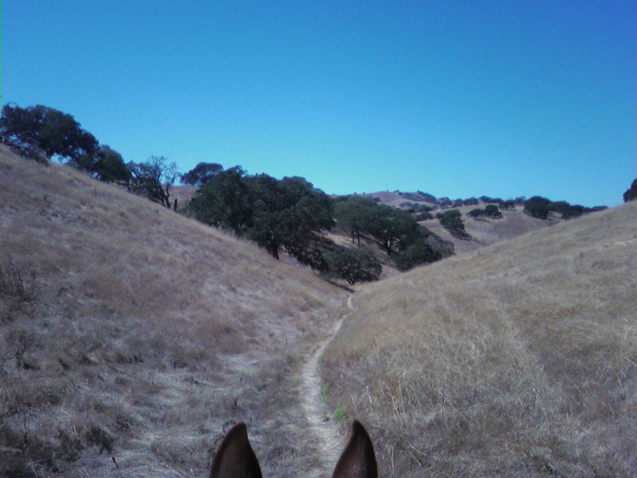
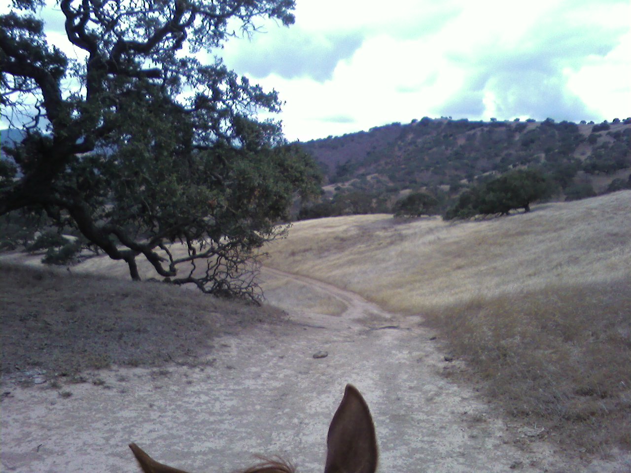
Since we still had a few more trails we wanted to ride before we left here on Monday, we made the rare decision to ride two days in a row, heading out on Spikes Peak trail back to the South Boundary Loop. While the maps the park provides at the kiosk are very good, there are a few signposts that need repair (though for the most part, it was very well-marked throughout, with posts at every intersection), and there was on post on the ground we almost missed because of the high grass and hard to see trail, but being that it mostly ran along the perimeter fence, it was easy to get back on track. As Ranger Lee had mentioned our first day, if we get lost, just head north and eventually we’ll bet back to the camp. Mostly the same kind of terrain we’ve had all along, but in one spot, the trees suddenly disappeared and the area was full of low bushes and brush, giving it a completely different look for about a half mile. This is definitely one of our favorite stops! While several other horse trailers came in for the day today, there were no other overnight campers the entire week we’ve been here, which really surprises us considering the close proximity it has to so many major roads and cities. They certainly could stand to do more publicity, but I guess that’s not in their budget. Meanwhile, this is one of the best kept secrets of Central California!
Saturday, September 11, 2010 – Another Fabulous Ride
September 12, 2010 By Leave a Comment

Hubby woke up feeling almost 100 percent this morning, confirming our decision to wait to ride was the right one. After a big breakfast, we saddled up and headed east to take the Dinosaur Lake Trail, which started east of the park entrance and wound around near the Windmill Farm, which our horses found a bit curious at first, but after a few good long looks, they carried on, taking them all in stride. It was another fabulous ride! The Spikes Peak trail, which we connected to from the Canyon Loop, starts at the highest peak of the property and then runs along the ridge line all the way back to camp, providing a long series of spectacular views that never got boring. If you want great views, the feel of wide open spaces while at the same time having an everchanging hilly view rather than the tedium of the plains, this is the place! Definitely high on our list of best places!
Friday, September 10, 2010 – More Recovery
September 11, 2010 By Leave a Comment
Hubby was better than yesterday, but still felt a bit weak and sore, we again, we decided to wait, as his health and recovery is more important than another ride. I took the opportunity to get caught up on some work and emails and research, as we have a halfway decent cell phone signal here.
Thursday, September 9, 2010 – Trailer Repair and Recovery Day
September 10, 2010 By Leave a Comment
Hubby woke up not feeling too well this morning (which always seems to happen after we come in contact with a lot of people, especially sneezing and coughing kids at Wal-Mart), so we decided to forgo our planned ride. We had a leisurely breakfast, then after a while, he felt well enough to try to tackle the trailer repair job. We managed to replace the panel in about an hour, and it looked great when we were done. Afterward, I made us a banana smoothie and sent him off to bed for a nap. He slept soundly for several more hours, which went a long way to making him feel better. Hopefully tomorrow we’ll get another ride in.
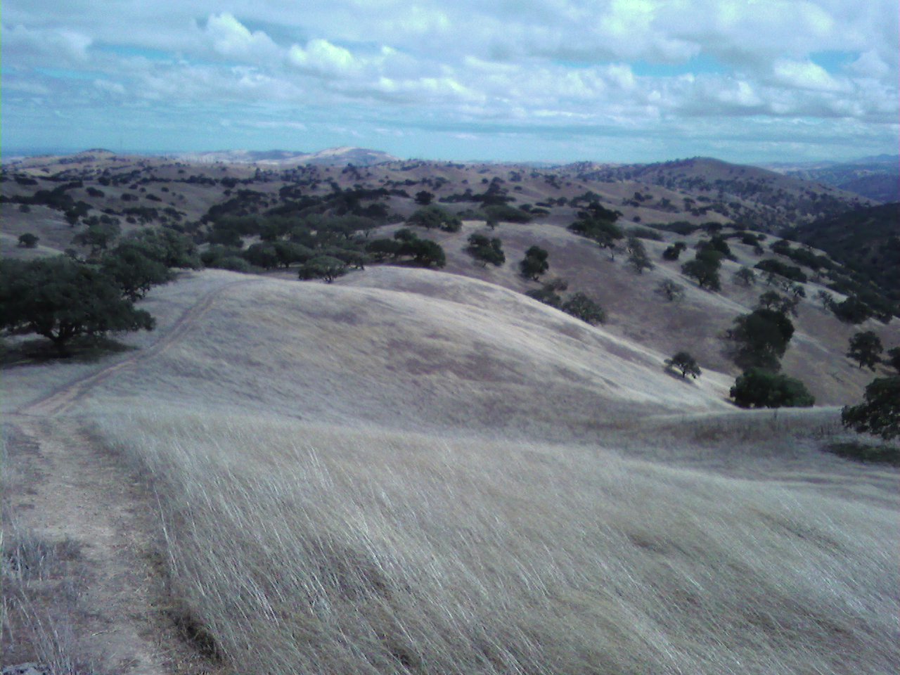
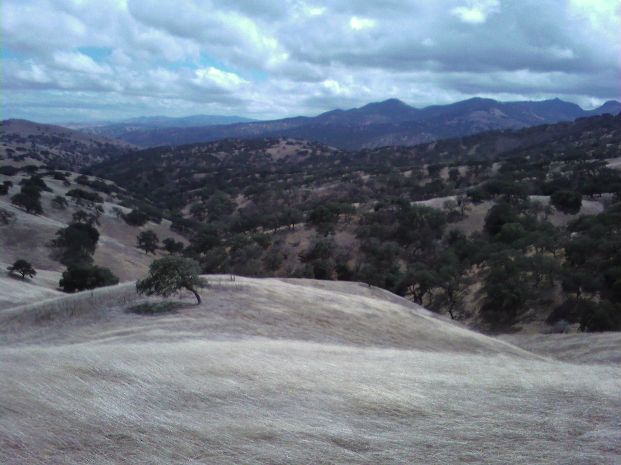
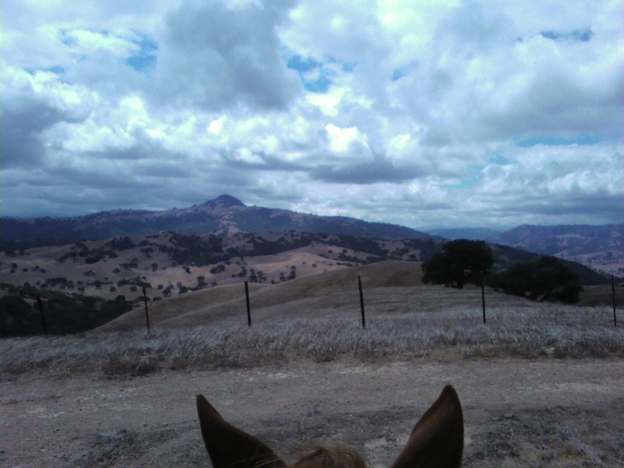
Wednesday, September 8, 2010 – Incredible Ride Day
September 9, 2010 By Leave a Comment
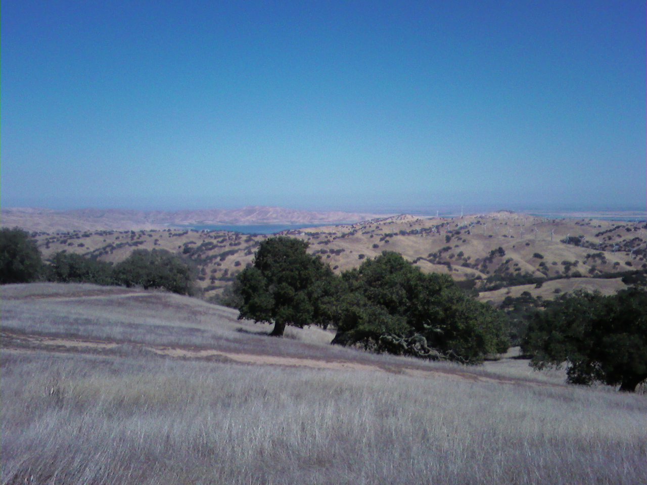
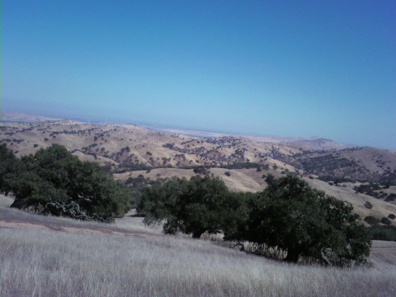
Woke up to another marine layer of fog, but the wind didn’t seem quite so bad, and the temps were a bit better, so we decided to give it a go today. We headed out late, nearly 1:00, as I was still finishing off some work in the morning. With map in hand, we headed out the Pig’s Pond trail, then turned onto the Tunnel Monument Trail. The hills were fairly steep in spots, but the trails seemed easy, maybe because none of them perched on the edge with a huge dropoff, or were so narrow as to be heart-stopping. These were more like a dirt road in most places, and a regular trail in others. The hill-and-dale feeling was very different from most places we’ve been, and you could quickly get used to being able to see where you are actually going before you get there, although it always seemed another hill was just ahead, and you wanted to see what was over THAT hill, and the next, and the next. The top of the trail at Tunnel Monument is by far one of the greatest vistas we’ve seen since we left home. A full 360 degrees of view! To the south and west, more hilly grasslands and scattered trees, with a range of higher mountains profiled in blue shade. To the northeast, an incredible view of the San Luis Reservoir, a huge lake that feeds this entire valley, which, in turn, practically feeds the world. To the southeast, a wind farm with a score or more of giant windmills, gracefully whirring in the distance. We learned later that the wind farm brings in enough revenue to support the entire park, though not quite enough for capital expenditures. Utterly stunning views all around. At the peaks, however, the wind was quite blustery, (Hubby kept losing his hat, bad cowboy!) so we headed downhill to Whiskey Flats trail, where it quieted down to almost a breeze. We were only out about 2 ½ hours, but it was a thoroughly enjoyable ride. We’re looking forward to seeing what the rest of the trails bring! When we got back, we headed in to Los Banos to pick up some groceries and a piece of plywood at Lowes so we could fix a rotten panel in the horse trailer. It had come loose inside it’s frame because it was rotten at the bottom, and somewhere along the line had popped out and scratched my gelding’s front leg a bit. Just a few scratches, but definitely an overdue project. Got back late, but had a nice steak and went to bed satisfied at the day’s productivity.